- Joined
- Oct 31, 1996
- Posts
- 1,445
- Type aircraft owned
- Carbon Cub FX-3
- Base airport
- KFCI
- Ratings
- COMM, IFR, MEL, SEL

YouTuber/TV Weatherman, One Other Killed in Loaner Carbon Cub Crash - AvBrief.com
Plane hit power line in canyon north of Boise.
 avbrief.com
Plane Crazy Channel
If you are CRAZY about aviation, you'll love this channel. Subscribe now and let's "take-off"! For business and collaboration inquiries, contact me at [email protected]
 www.youtube.com
From Facebook:
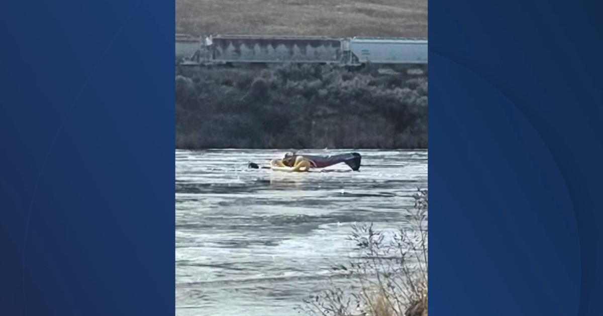
Plane crashes into Payette River east of Emmett, killing two male passengers
A plane crashed into the Payette River in the Black Canyon area east of Emmett on Tuesday morning, killing two male passengers, the Gem County Sheriff's Office confirmed.
 www.kivitv.com

KTVB
Official YouTube channel of KTVB Idaho's News Channel 7 in Boise. Watch nearly every segment right after it airs on TV, covering everything from high school sports to development and growth in the Treasure Valley. Get more of Idaho's leading news and weather at http://www.ktvb.com
www.ktvb.com
Last edited:


